If boating access is high on your list, Sugarloaf Key can look simple at first glance. In reality, it is a location where the exact street, canal pocket, and nearby bridge sequence can shape your day on the water. If you are considering buying or selling here, understanding that local geography can help you make better decisions with more confidence. Let’s dive in.
Sugarloaf Key Boating Geography
Sugarloaf Key sits in the Lower Keys as part of a corridor of islands connected by channels, bridges, and neighboring boating routes. Monroe County’s bridge table places the Lower Sugarloaf bridge at MM15.5, followed by Harris Channel at MM16.5, Harris Gap at MM17.6, Park at MM18.7, and Bow at MM20.1, with Fire Station 10 at MM17 on Sugarloaf Key according to Monroe County bridge and location materials.
That matters because Sugarloaf is not a single uninterrupted waterfront edge. The USGS Sugarloaf Key topo map identifies Sugarloaf Shores on the Atlantic side and shows surrounding water bodies including Upper Sugarloaf Sound, Lower Sugarloaf Sound, Lower Sugarloaf Channel, Harris Channel, Harris Gap Channel, Park Channel, and Bow Channel.
For you as a buyer or owner, the main takeaway is simple: a Sugarloaf Key address does not tell the full boating story by itself. The closest water body, the canal layout, and the route out all depend on the home’s exact position.
Canal Living Is Pocket-Specific
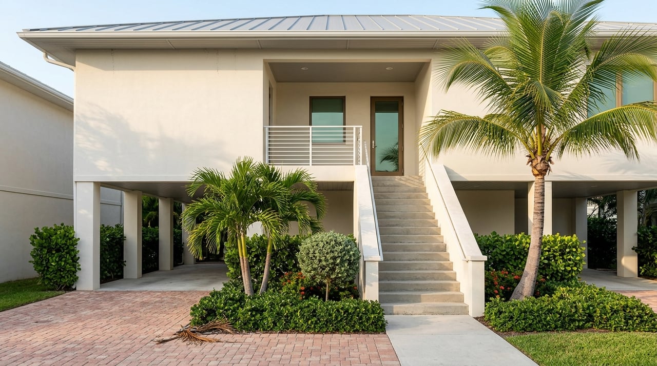
One of the most important things to understand about Sugarloaf Key is that canal-front living is concentrated in specific neighborhood pockets. Monroe County materials point to canal-area clusters within Sugarloaf Shores Section C, Section D, Section D Ext, and Section F, along with streets such as Sugarloaf Dr, Marlin Dr, Bonita Ln West, Bonefish Ln West, La Brisa Ln, and Wahoo Ln in the county’s vulnerability assessment appendix.
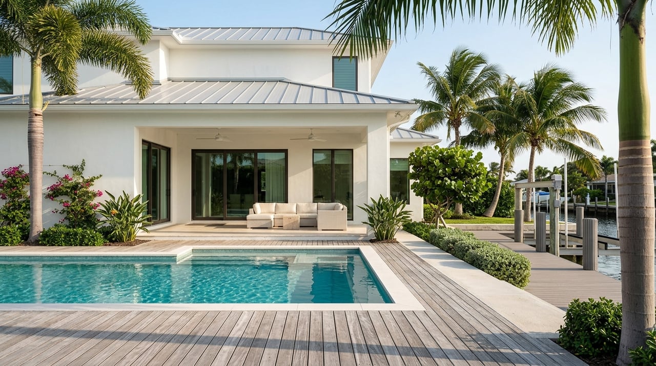
That means two homes on Sugarloaf Key can offer very different boating setups, even if they are close together on a map. One property may have a shorter and more direct dock-to-channel run, while another may sit deeper inside a canal pocket.
This is why broad statements about boating access can miss the mark. On Sugarloaf Key, micro-location matters more than the island name alone.
Why Canal Condition Can Change
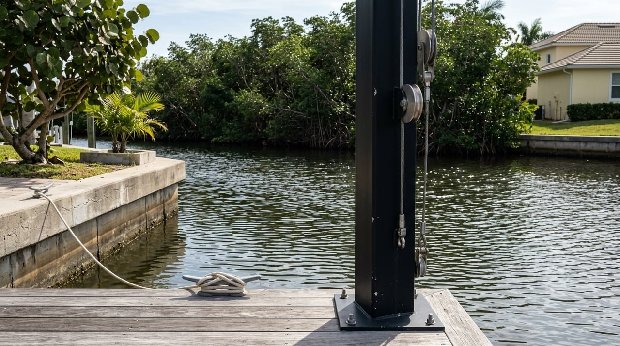
Canal living also comes with a practical reality: canal condition is not fixed forever. Monroe County’s residential canal inventory and bathymetry report lists many Sugarloaf Key canals, and at least one Sugarloaf canal was noted as too shallow and overgrown at the mouth to be surveyed normally.
That same county framework also treats canal restoration or maintenance as an eligible neighborhood project type. In practical terms, that reinforces an important point for buyers and sellers alike: a canal’s usability can be shaped by ongoing conditions, not just by the original plat map.
If you are evaluating a home, it helps to look beyond the dock itself. You also want to understand the canal mouth, its current condition, and how that specific route connects outward.
Bridges Shape Real Boating Access
When people talk about boating access in the Lower Keys, they often focus on open water. On Sugarloaf Key, bridge sequence and bridge proximity are often just as important.
Official county materials identify the Lower Sugarloaf bridge, Harris Channel bridge, Harris Gap bridge, North Harris bridge, Park bridge, and Bow Channel bridge in this corridor. As shown in Monroe County reference materials, these crossings are part of the practical route structure that shapes movement around Sugarloaf and nearby waters.
For you, that means a home’s boating convenience is often tied to what lies between the dock and the broader channel system. Even within the same island market, one property may feel far more straightforward on the water because of its local route geometry.
Shallow Water and Marker Systems Matter
In the Lower Keys, boating decisions are not only about distance. They are also about navigating shallow-water areas responsibly and understanding the local infrastructure that supports safe use.
Monroe County explains that its Waterway Markers system is designed to assist boaters and help protect shallow-water resources. The county also notes that Marine Resources manages marker maintenance, pump-out services, boat-ramp repairs, and related waterway infrastructure.
That is useful context if you are weighing a waterfront purchase. It shows that local boating access is part of a larger managed system, where route guidance and water conditions both play a role in day-to-day use.
What Buyers Should Look At First
If you are shopping for a canal home on Sugarloaf Key, it helps to evaluate each property with a very local lens. A polished waterfront photo is only the starting point.
Focus on these factors first:
- Canal pocket location within Sugarloaf Shores or another named section
- Route from dock to channel, including turns and canal mouth position
- Nearby bridges that shape the path out
- Current canal condition, especially near the mouth
- Relationship to surrounding water bodies such as sounds or channels shown on the USGS map
This kind of review can help you compare homes more accurately. It also helps you avoid assuming that every canal-front listing on Sugarloaf Key will function the same way.
What Sellers Should Understand
If you own waterfront property on Sugarloaf Key, your boating story should be presented with precision. Buyers in this market often want details, not general claims.
Instead of relying on broad phrases, it is smarter to position a property based on its specific canal pocket, route characteristics, and surrounding geography. That gives buyers a clearer picture and helps your home stand apart for the right reasons.
For higher-value waterfront homes especially, careful positioning can make a difference. Clear, accurate marketing supports credibility and can help attract better-informed buyers.
How Sugarloaf Compares Nearby
Sugarloaf Key is part of a broader Lower Keys boating network, not a stand-alone boating environment. The FWC Lower Keys boating guide covers Sugarloaf along with Saddlebunch, Cudjoe, Summerland, Ramrod, Big Pine, and Bahia Honda.
Nearby public-ramp options also show how boating setups vary by island. Monroe County’s boat ramp information notes that Big Pine’s Eden Pines ramp serves a long residential canal network that reaches open water, Little Torch’s State Road 4A serves a residential canal area that reaches open water, and Cudjoe’s Blimp Road ramp is a bayside facility at MM21.2.
The practical takeaway is that Sugarloaf Key is best understood as a private-dock, canal-geometry market. Here, the exact street and canal mouth often matter more than broad island-wide assumptions.
Why Local Guidance Helps
Sugarloaf Key rewards a detailed approach. If you are buying, you want to understand not just whether a home is waterfront, but how that waterfront actually functions in daily use. If you are selling, you want your property positioned with the level of accuracy that serious waterfront buyers expect.
That is where local market knowledge becomes valuable. A measured, property-specific view can help you evaluate boating access, canal living, and location tradeoffs with much more clarity.
If you are considering a purchase or sale in Sugarloaf Key, Lisa Swanson offers informed, high-touch guidance across the Florida Keys with the discretion and market insight waterfront clients value.
FAQs
What does boating access mean for a Sugarloaf Key home?
- Boating access on Sugarloaf Key depends on the home’s exact canal pocket, nearby bridges, surrounding channels, and the condition of the canal route leading outward.
What should buyers check about Sugarloaf Key canal homes?
- Buyers should review the canal location, route from the dock to the main channel system, bridge sequence, and any shallow or overgrown conditions near the canal mouth.
Are all waterfront homes on Sugarloaf Key similar for boating?
- No. County and map sources show that canal-front homes are concentrated in specific pockets, so two homes on the island can have very different boating routes and water relationships.
How do bridges affect Sugarloaf Key boating access?
- Bridges are a major part of the local access pattern because they help define the route structure between residential canal areas and the broader surrounding waterways.
How does Sugarloaf Key compare with nearby Lower Keys islands for boating?
- Sugarloaf Key is part of a connected Lower Keys boating corridor, but official sources suggest it is best viewed as a private-dock market where street-level canal geometry matters more than general island labels.